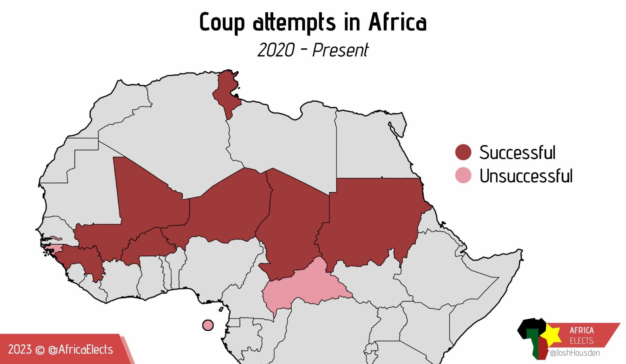
Can someone explain what these countries have in common that they form this straight line across north africa?
They are all in the Sahel region. The Sahara is expanding into them as the climate changes.
This. Climate pressure is agriculture pressure is economic pressure is political pressure.
Doesn’t seem to bode well for the Great Green Wall project, does it?
I'll take a wild guess and say "russias Wagner mercenary troop is active there"
Edit: Im not joking, they immediately flew the russian flag after the coup was successful
the Wagner group is active across this region, typically hired by juntas that displace the western-allied governments and pay the Wagner group for security by granting Wagner control over some resource extraction
That's kind of a chicken and the egg thing - mercenary groups are probably bad for stability, but on the other hand they're not really operating in regions that weren't pretty unstable in the first place.
I really think that is about islamic extremism, especially ISIS related grousp. Not that these groups attempt coups directly but they cause an absurd amount of political chaos
Amongst the poorest in Africa.
The one in Niger was this week! https://apnews.com/article/niger-mutinous-soldiers-attempted-coup-2efab1649bea7d89b14dbc9432f5f819
What about southern Africa?
What about them? They're not on this map. Probably because they haven't had as much of a spate of coups so including them just makes the effect look less dramatic.
Where's Egypt and al-Sisi??
That was in 2013/14, and the post is "since 2020".
That was way before 2020
You are right. My apologies!
MapPorn
Discover Cartographic Marvels and Navigate New Worlds!
Rules
- Be respectful and inclusive.
- No harassment, hate speech, or trolling.
- Engage in constructive discussions.
- Share relevant content.
- Follow guidelines and moderators' instructions.
- Use appropriate language and tone.
- Report violations.
- Foster a continuous learning environment.
