this post was submitted on 30 Nov 2024
363 points (98.1% liked)
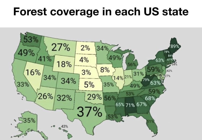
Map Enthusiasts
4729 readers
28 users here now
For the map enthused!
Rules:
-
post relevant content: interesting, informative, and/or pretty maps
-
be nice
founded 2 years ago
MODERATORS
you are viewing a single comment's thread
view the rest of the comments
view the rest of the comments
What exactly is deceptive about that?
Because it's not evenly distributed, but a good 30% of the state is heavily forested and another good 20% is forested but not heavily so. The map gives an impression (for each state really) that it is an even distribution in some way. Really, doing this in a state-by-state way as if political boundaries all made geographic sense is not very informative.
Minnesota is heavily wooded, but only up north. It's not deceptive, it's how trees work.
How do the trees know to stay north? They got Tree-PS or something?
The south is where the forests from Canada give way to the Great Plains of the Midwest. Just a quirk of the geography.