this post was submitted on 22 Feb 2026
332 points (98.3% liked)
Just Post
1356 readers
559 users here now
Just post something 💛
Lemmy's general purpose discussion community with no specific topic.
Sitewide lemmy.world rules apply here.
Additionally, this is a no AI content community. We are here for human interaction, not AI slop! Posts or comments flagged as AI generated will be removed.
founded 2 years ago
MODERATORS
you are viewing a single comment's thread
view the rest of the comments
view the rest of the comments
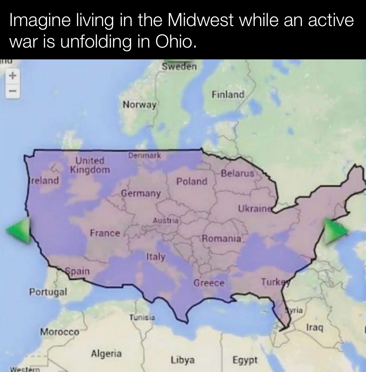
is this an accurate representation of the US landmass ? I was under the impression they were much biger than that..., but they're roughly the size of Europe ?
Alaska and Hawaii aren't pictured.
Because they'd be in Morocco!^[As any good US elementary school map of the US would show!]
The USA is slightly smaller than Europe (not the EU) if you include Alaska and Hawaii
Yes it is https://thetruesize.com/
It looks just slightly bigger than in the OP's screenshot
The two "maps" are wildly out of proportions anyway. Looks like Sweden is the size of the entire US West Coast. When in reality it's about the size of California
Given how the US border is distorted (Maine is north of the 49th parallel) I'm guessing this is one of those maps that distorts things as you move them around to keep the area constant. Like look how big Greenland looks up in the corner.
Greenland is not in the image
Then what is the unlabeled landmass at the very top left, northeast of Iceland?
The entirety of Oregon and most of California and Washington are ocean in this image
The whole continent of Europe is slightly bigger than the USA. The EU (union) is smaller than the USA.