Specifically, this shows current and future wildfire risks.
this post was submitted on 10 Feb 2026
28 points (100.0% liked)
Climate
8433 readers
294 users here now
Discussion of climate, how it is changing, activism around that, the politics, and the energy systems change we need in order to stabilize things.
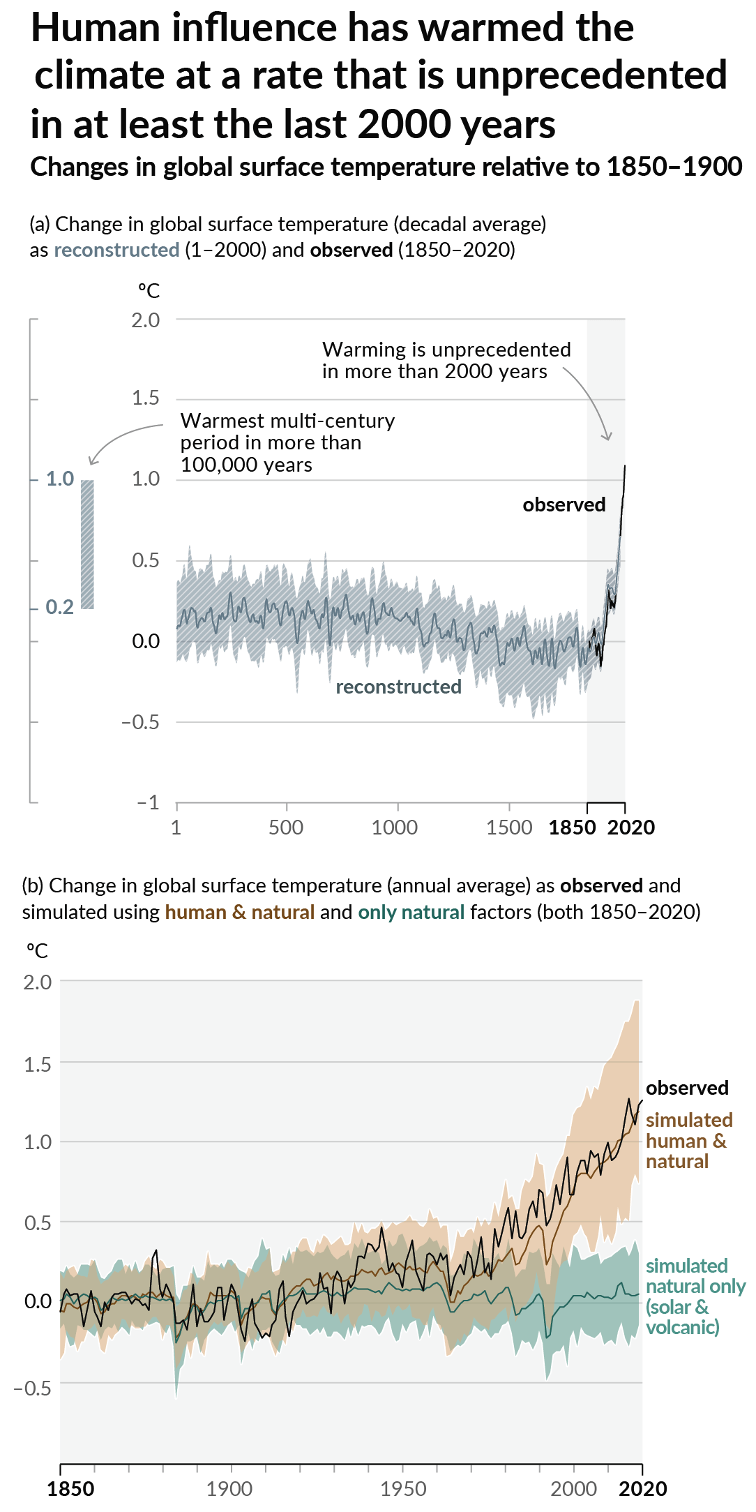
As a starting point, the burning of fossil fuels, and to a lesser extent deforestation and release of methane are responsible for the warming in recent decades:
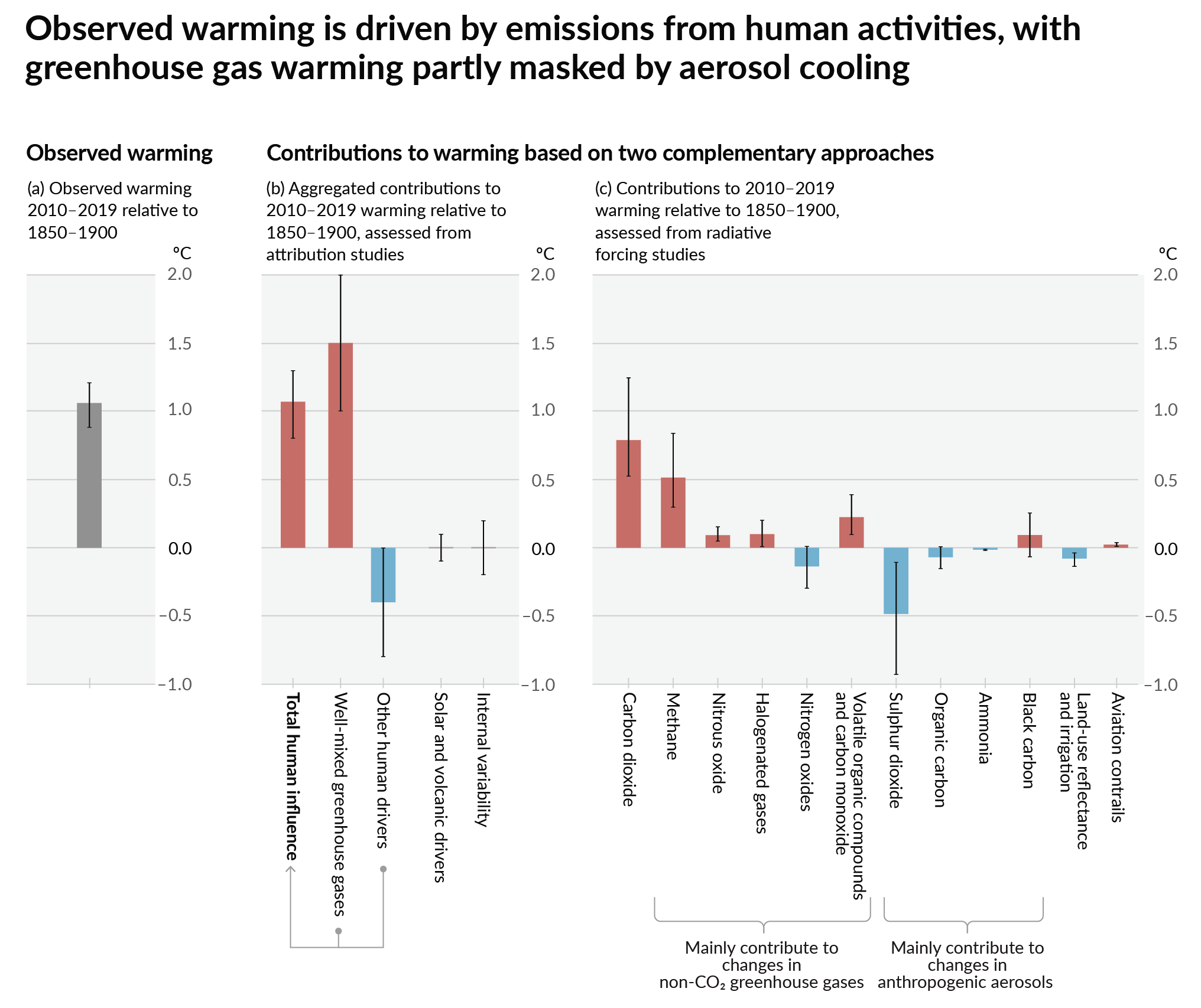
How much each change to the atmosphere has warmed the world:
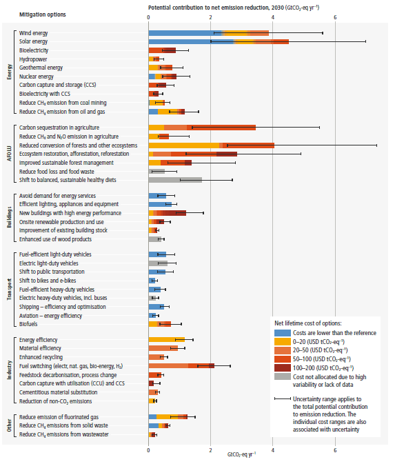
Recommended actions to cut greenhouse gas emissions in the near future:
Anti-science, inactivism, and unsupported conspiracy theories are not ok here.
founded 2 years ago
MODERATORS
And according to their docs, flood risk coming soon as well. I would love to see projected drought at some point too! Heat and hurricanes are the other main climate-fueled threats, but they're pretty easy to predict (stay out of the South, stay away from coasts).
I like that this project is opening up granular data to the public. First Street is great for simple searches (and their subscriptions are reasonably priced as well), but if you want direct access to their data it's $10K-$15K/year and up.
These maps never include Alaska or Hawaii despite the myriad risks in those places.
The USGS hydrology data in them is lot worse than the lower 48, which makes it a lot harder to do. The whole Aleutian Islands chain is treated as a single hydrological unit for example.
The fire models are also specific to plant community, which means they wont apply to a lot of the situations in those states.